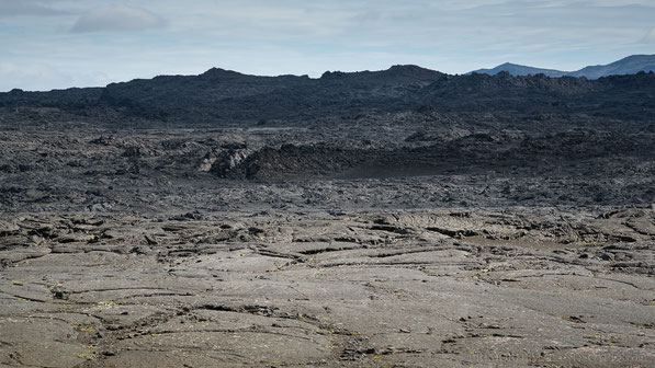
Svartadyngja
"Svartadyngja is situated 8 km west of Herðubreiðartögl and 8 km south of Flatadyngja. Like the latter, Svartadyngja is a very low and flat, depressed lava cone, the summit of which has an altitude of 758m.
Part of its lava flowed southeast- and eastward, passing through the gateway between Herðubreiðartögl and Miðfell, and disappearing beneath the sandur halfway to Hlaupfell at about
580m.
[...]
The crater of Svartadyngja consists of some sinks, craterpits and tilted blocks of lava surrounded by a more level area, which is presumably a larger sink filled by lava which has flown over its borders."
- R.W. van Bemmelen and M.G. Rutten: Tablemountains of Northern Iceland, Utrecht 1955 -

Picture of the Month